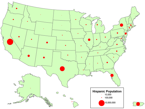
A proportional circle map is a map which represents certain information in a geographical area by using circles proportionate to the represented information. In other words, if the circles are small, then the number of what ever is being measured is small and vice versa if the circles are large. This specific map shows the Hispanic population in the United States. Notice that the smaller circles represent a smaller number of people, while the larger circles represent a large number of people.
Direct URL: https://www.e-education.psu.edu/natureofgeoinfo/book/export/html/1553
No comments:
Post a Comment